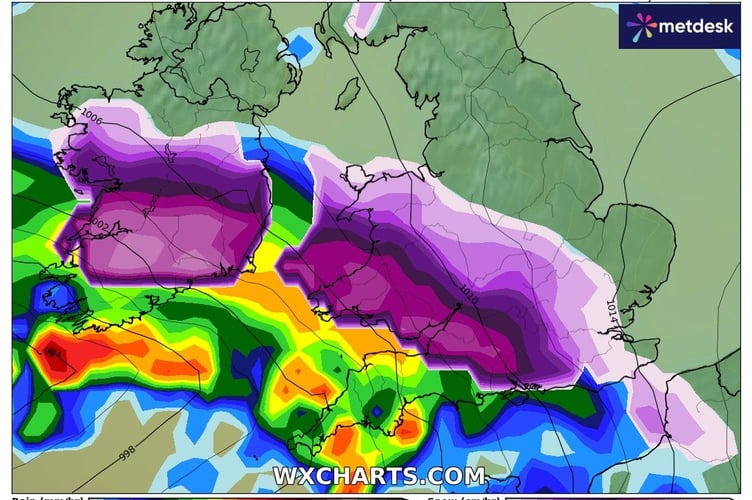
The Met Office has issued a yellow weather warning for heavy snow this weekend.
The warning covers the entirety of mainland Wales, with forecasters saying between 20-30cm of snow is possible on high ground.
The warning runs from midday Saturday until 9am on Monday.

Coastal areas like Aberystwyth very rarely see snow sticking to the ground, however Accuweather says there is a 65 per cent chance of between 2-4cm in the town on Saturday night.
Dan Holley, Deputy Chief Forecaster for the Met Office, said: “An Atlantic frontal system is likely to move across parts of central and southern UK through the weekend. "With milder, moisture-laden air engaging with the cold conditions already in place this may bring a spell of snow in some areas, before possibly turning back to rain in the south.
“At this stage there is a fair amount of uncertainty over exactly which areas will see disruptive snow, with parts of Wales, northern England and the Midlands most likely to see some impacts.
"Here we could see 5cm or more in quite a few areas, and perhaps as much as 20-30cm over high ground, including Wales and the Pennines.
"Coupled with strengthening winds this could lead to drifting, making travelling conditions difficult over higher-level routes in particular.
“We’ve currently issued a Yellow warning for snow covering a large part of England, Wales and southern Scotland to cater for possible disruption over the weekend, but it’s quite likely this will be refined over the coming days as confidence in the forecast increases. So it’s worth keeping up to date with the latest warnings.”
The Met Office warning adds that there is a small chance that power cuts will occur and other services, such as mobile phone coverage, may be affected
There is also a slight chance that some rural communities could become cut off due to the snow, along with travel delays.
The full warning says: “Outbreaks of rain spreading progressively northeastwards later on Saturday and overnight into Sunday will likely be preceded by a spell of snow on its northern flank.
“Whilst there is some uncertainty, any snow in southern and eastern parts of England, especially at low levels, will probably be rather transient before turning back to rain.
“However, some significant accumulations of snow are possible across parts of Wales, the Midlands and northern England in particular, at least for a time, where 5 cm or more could accumulate fairly widely, with perhaps as much as 20-30 cm over high ground of mid and north Wales and potentially 30-40 cm over parts of the Pennines.
“This, accompanied by strengthening winds, may lead to drifting of lying snow.
“In addition, as milder air moves northwards, snow may turn to a spell of freezing rain for a time, again more especially across parts of Wales, the Midlands and northern England, adding to the risk of ice and leading to some treacherous conditions in places.
“A fairly rapid thaw of lying snow is possible later on Sunday, although exactly how far north the rapid thaw will reach remains uncertain at this stage.”


