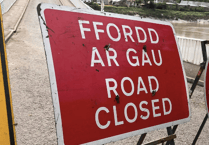
Storm Ellen is sweeping across the region, bringing strong winds and heavy rain.
High wind warnings have been in place since yesterday (Thursday) and remain in place for today.
One reader, Rose Voon, sent us this dramatic photo of Aberystwyth’s harbour being battered by waves.
The Met Office said the “unseasonably deep Atlantic low-pressure system brought very strong winds” and gusts of 79mph recorded at Capel Curig, North Wales, yesterday morning.
Met Office chief meteorologist Paul Gunderson said: “Storm Ellen was a very lively storm for this time of year and although the main system has mostly dissipated, we’ll continue to see strong winds across western parts of the UK today spreading to eastern areas tomorrow, with several yellow wind warnings in place.”
Deputy meteorologist at the Met Office, Dave Oliver said: “Along with the sometimes heavy rain, strong winds have the potential to cause impacts that are not common in August.
"With this spell of unsettled weather coinciding with trees in full leaf and a peak in the camping season, wind-related impacts are more likely at lower wind speeds compared to other times of the year.”
RAC breakdown spokesperson Rod Dennis said: “This spell of autumnal-feeling weather is going to make driving conditions very unpleasant for a lot of us over the next few days.
"Strong winds will mean journeys by road will take longer than usual, and could be affected by fallen branches on the roads. Add in some very intense rainfall and drivers will need to take real care to complete their trips safely.
“We urge every driver heading out to make sure their car is up to the task to avoid a breakdown in the wind and rain, especially if they’re towing or taking a longer trip – in particular check the condition and pressure of all tyres before setting out.
"When driving, slow down and pay close attention to high-sided vehicles and other drivers with caravans and trailers to give yourself plenty of time to react should any run into difficulties.”


