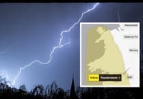
PARTS of the UK are under red alert as Storm Éowyn approaches.
Parts of Wales currently have yellow warnings for wind and rain, which upgrade to amber tomorrow.
A red alert has been issued for Scotland and Northern Ireland with disruptive winds, heavy rain and snow expected.
All of Ireland is under red alert as the storm approaches.
Met Office Chief Meteorologist Paul Gundersen said: “We reserve the issuing of Red Warnings for the most severe weather which represents a likely danger to life and severe disruption, and that is the case with Storm Éowyn.
“While it will be widely very windy on Friday, with additional hazards from rain and snow, the strongest winds and most significant impacts are likely in Northern Ireland and central and southwestern parts of Scotland within the Red Warning areas, where winds could gust 80-90 mph quite widely for a time, and potentially up to 100 mph for exposed coasts in particular.”
After Storm Éowyn on Friday and early on Saturday, further wet and windy weather is likely on Sunday and at the start of next week, with further warnings issued.
A Yellow warning for winds in western parts of Wales, southwest England and the southern coast of England is currently in force until 6pm this evening.
Storm Éowyn will begin to influence the UK’s weather early on Friday, with strengthening winds initially in southwestern parts of the UK with accompanying heavy rainfall. This will quickly spread northeast to the rest of the UK during Friday morning.
Met Office Chief Meteorologist Paul Gundersen continued: “Storm Éowyn is a multi-hazard event, with snow likely for some, rain for many and strong wings for much of the UK. As a result, a number of weather warnings have been issued, with all parts of the UK covered by one warning at some point on Friday."
Travel conditions are likely to be severely disrupted in the coming days. Mark Nash, Duty Manager at National Highways, said: “We are expecting high winds and rain to hit most parts of the country later this week. If you're planning to drive over the next few days, prepare in advance for the journey and take extra care on the roads. If weather conditions become challenging, adjust your driving behaviour to manage the conditions as safely as possible.
“We have a section of our website dedicated to travelling in storms, high winds and gales, and considerations for different types of vehicles, as part of our guide to travelling in severe weather.”
Wales warnings
Yellow warning for winds in western parts of Wales from 07:00 until 18:00 Thursday.
Yellow warning for rain across much of Wales from 00:00 until 09:00 Friday.
Yellow warning for winds for much of Wales from 05:00 until 23:59 Friday.
Amber warning for wind for north Wales from 06:00 until 21:00 Friday.
Winds picking up in western parts on Thursday, bringing a 4-to-5-hour spell of strong and gusty winds. Winds are expected to reach 50-60 mph over exposed coasts and hills. Heavy rain arrives for much of Wales on Friday as well as strong winds. Winds will be strongest in north Wales, where peak gusts of 60-70 mph are expected fairly widely inland, with 70-80 mph in some areas, and 80-90 mph along more exposed coasts and hills.
Further Ahead
As Storm Éowyn weakens and clears to the northeast of the UK, Saturday will remain a breezy day everywhere with strong winds persisting in the north. It will be drier for many, with showers replacing persistent heavy rain, these wintry in the north, especially over higher ground.
However, a further area of low pressure will influence the UK’s weather from Sunday, initially in the west, but spreading further east and bringing further wind and rain from Sunday and into the start of next week, with further warnings issued.


Comments
This article has no comments yet. Be the first to leave a comment.