THE MET Office has updated its forecast for the week ahead, with snow possible across the region.
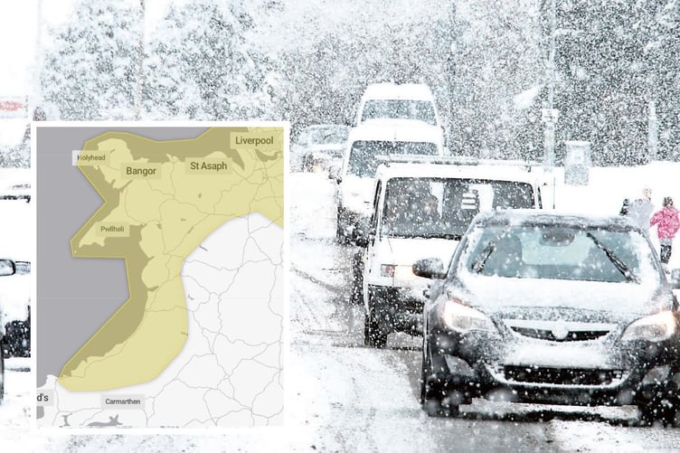
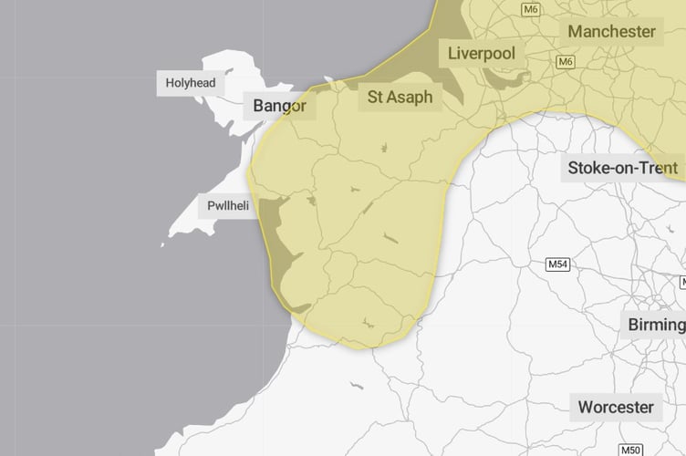
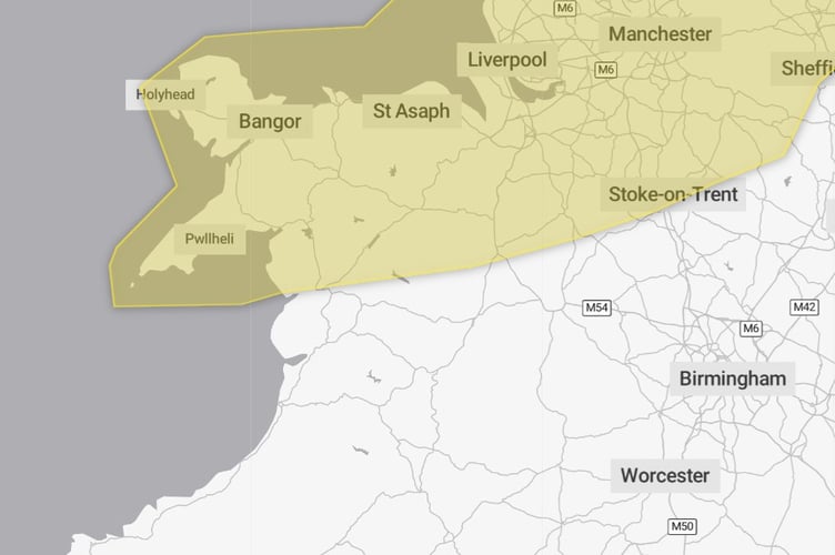
A previous warning for snow across the west coast has been cancelled and replaced by a yellow warning for snow and ice throughout Thursday.
On Thursday, the Met Office says: "A band of snow showers will start the day running across parts of west Wales, however as the wind changes to a more northwesterly direction these will increasingly affect parts of, north Wales, northwest England, and perhaps reaching parts of the northwest Midlands later in the day.
"Generally many places in this area will only see 1-2 cm or so of snow, with any quickly melting on the immediate coastlines.


"However, where showers align, some narrow corridors could see 5-10 cm of snowfall. This most likely in parts of northwest England.
"In addition, ice will likely be a significant hazard across much of the region."
There are other warnings throughout the week, starting on Tuesday.
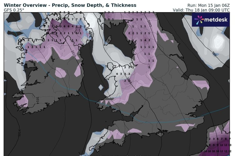
This yellow warning for snow and ice says: "Snow showers will continue to feed inland early on Tuesday morning across northern and western Scotland, parts of Wales and northwest England where 2-5 cm of snow is possible over a few hours in some places.
"During the day, an area of more organised rain, sleet and snow is likely to move east with further showers following. There is still some uncertainty in the track of more prolonged snow, and it is possible that at lower elevations across Wales and northern England, this could turn to rain for a time.
"However, there is a chance some places could see 5-10 cm perhaps 20 cm of snow, particularly across the northern half of Scotland and over higher ground elsewhere."
Another warning is in place for Wednesday morning from midnight to midday, saying: "A band of sleet and snow is likely to continue to push across this area and towards the southeast during the first part of Wednesday.
"This could bring 1-2 cm of snow over the hills in the region, with a small chance of around 5 cm falling in one or two upland areas.
"At lower elevations sleet or very wet snow is likely, but no settling of snow is expected.
"As this band of sleet and snow clears to the southeast, temperatures will fall below freezing leading to widespread ice developing."
Met Office Chief Meteorologist, Andy Page, said: “Where and how much snow we will get will vary throughout the week and weather warnings could change quickly, you will need to keep an eye on the forecast for your region for the latest information.
“There will be widespread frost this week and we could see some fairly deep laying snow in parts of northern UK and strong winds could result in drifting or blizzard conditions at times.
"The snow and ice will be disruptive and could potentially impact travel plans, make driving dangerous and pavements slippery.
“It will feel bitterly cold with daytime temperatures in the low single figures for many, and overnight temperatures will fall to -3 or -4 in many towns and cities, and it will be even colder in many rural areas.”
Comments
This article has no comments yet. Be the first to leave a comment.