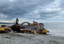
AN ABERYSTWYTH software company has produced a dramatic video which shows how large parts of the town are at risk of flooding.
West Coast Software, based in Aberystwyth Science Park, has teamed up with Aberystwyth University to produce a short but shocking video which visualises in 3D the flooding risk faced by large parts of the town and surrounding areas.
At high risk of flooding, according to the video, is the majority of the Rheidol valley between Trefechan and Lovesgrove, including lower parts of Penparcau.
Llanbadarn Fawr and Plascrug are at medium risk of flooding, while the entirety of the promenade and lower levels of Aberystwyth town centre at a low risk of flooding.
West Coast CEO Ken Bird described how the video visualises Aberystwyth becoming “immersed” by water.
He said: “Aberystwyth University supplied the data for West Coast to create and develop the software, with the support of LADAR, Ordinance Survey, Google Earth and the Environment Agency, to produce and demonstrate a complete state-of-the-art 3D visual of Aberystwyth being immersed by a combination of high tide and already raised banks by the wet weather, but also more importantly to identify Aberystwyth as a risk for flooding in the future.”
See this week’s south editions for the full story, in shops and online tomorrow


