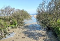
Tŵr Gweno / Egg Rock on the coast between Aberystwyth and Llanrhystud, was a local landmark and popular tourist attraction in Victorian times.
Its disappearance more than a century ago is evidence of our constantly changing coastline, as explained in this article to mark International Geomorphology Week 2025 (3-8 March), written by researchers Professor Stephen Tooth from the Department of Geography and Earth Sciences at Aberystwyth University, and Courtney Goode, who recently graduated with a Master’s degree in Environmental Change, Impact and Adaptation from Aberystwyth.

Over the last few decades, we have become increasingly aware that the world’s environment is changing. Geomorphology is the science studying the origin and development of landforms — such as mountains, valleys, sand dunes and caves — and how they combine to form landscapes. As local geomorphologists working with colleagues at Aberystwyth University and in the local community, we are particularly interested in how rapidly change has been occurring to rocky landforms along the Ceredigion coastline over the last 150 years. Visual archival materials – geological sketches, paintings, and photographs – provide invaluable lines of evidence, and help solve mysteries. For example, uncertainty has surrounded the timing of the disappearance of former coastal stack Tŵr Gweno/Egg Rock, which was a well-known Victorian tourist attraction. Alfred Worthington’s painting on display in Ceredigion Museum and photographs from the late 1800s and early 1900s including one from the collection of the National Monuments Record of Wales: David John Saer Album Collection, show this landform in various stages of erosion. We can arrange the photographs in order based on the changing size and shape of Tŵr Gweno/Egg Rock, and compare the timeline with newspaper reports highlighting its gradual demise owing to wave attack. As a result, we can say with confidence the landform was lost in a coastal storm in 1907. By comparing the remaining coastal features with more recent photographs, we can also find the former location of Tŵr Gweno/Egg Rock.
Similar approaches are being taken to reconstruct the development of other local coastal landforms, including: Craig y Delyn/Harp Rock, south of Borth; Craig y Fulfran/Cormorant Rock and Allt Wen near Aberystwyth; and Twll Twrw/Monk’s Cave near the former Tŵr Gweno/Egg Rock.
More research needs to be done to establish patterns of change along this dynamic coastline. We appeal to anyone with sketches, paintings or photographs of the local coastline to contact us. Most useful are images of specific coastal landforms at least 10 years old, particularly if taken from locations that can be easily identified and revisited. Use of visual archival materials to reconstruct coastal landform changes provides a valuable historical perspective that can complement shorter term monitoring of change using advanced technology, such as drone surveys.
We are grateful to the National Monuments Record of Wales: David John Saer Album Collection, and Ceredigion Museum for allowing us to use images of Egg Rock from their collections.
Readers who would like to share their photographs can email Stephen Tooth ([email protected]).

.png?width=209&height=140&crop=209:145,smart&quality=75)


Comments
This article has no comments yet. Be the first to leave a comment.